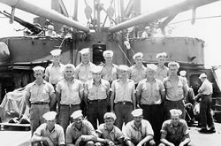
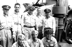
USS Pavlic - APD-70 A History |
Trip to the War Zone
Pavlic's route to the war zone, dates and locations: |
||
| December 18, 1943 | Pittsburgh, PA | Pavlic launched as the DE 669 |
| December 29, 1944 | Orange, TX | Pavlic APD –70 Commissioned |
| January 20, 1945 | Bermuda | Pavlic conducts shakedown tests |
| February 22, 1945 | Norfolk, VA | Readied for sea. |
| February 28, 1945 | Panama Canal | Entered the Pacific Ocean |
| March 15, 1945 | San Diego | Final provisioning |
| April 13, 1945 | Hawaii | Final Training Completed, sailed for Japan |
| April 19, 1945 | Majuro, Marshall Is. | |
| April 28, 1945 | Ulithi, Marianas Is. | |
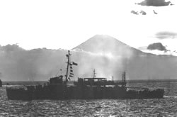
| May 3, 1945 | Okinawa, Ryukyu Is. | |
I boarded the USS Pavlic at Norfolk and was assigned to be a member of the radio crew. My job was to copy code, which I did as we went through the Caribbean and Panama Canal, up the west coast to San Diego, and then out to Hawaii. My General Quarters station was “bridge radioman”, which put me up on the flying bridge when there was a “red alert”, an attack situation.

USS Franklin burning and listing after
Japanese air attack, 19 March 1945.
We spent three weeks in Hawaii, practicing gunnery and cooperating with underwater demolition teams (UTD”s) training off Maui. We did not work with UDT’s after that, but a lot of APD’s did. There were 1000 UDT personnel clearing the approaches to the beaches for the Okinawa landings, which happened a month before we got there.
While we were in Hawaii, the actual invasion of Okinawa took place, April 1, 1945. We heard rumors of suicide planes but didn’t really believe them. Going on liberty into Honolulu from Pearl Harbor, I remember going past the huge blackened hulk of the USS Franklin (CV 13), a big aircraft carrier, that had just gotten back to Hawaii under her own power after being heavily damaged by dive bombers off the coast of Japan. That really brought the war home to me. The picture (right) gives you some idea of what she looked like after 2 bomb hits.
Leaving Hawaii, we provided anti-submarine escort for various ships, first to Majuro, in the Marshall Islands, and then on to Ulithi, in the Carolines. Ulithi was a huge anchorage with small islands all around it, and was the marshalling point for all the fleet operations from there to the west at that time, principally for the mopping up operations in the Philippines and support of the Okinawa campaign.
 |
The atoll ran roughly twenty miles north and south by about ten miles across enclosing a vast anchorage with an average depth of 80 to 100 feet. For a few months it was the biggest and most active naval base in the world. Like most ship’s crews there, we got ashore on the little island of Mog Mog and were issued a couple of cans of beer. By the time we got to Ulithi, Iwo Jima had been invaded to provide emergency airfields for B-29 raids originating from Tinian and Saipan to bomb the Japanese mainland. On April 29th we left Ulithi with two other APD’s escorting a convoy of nine other ships heading for Okinawa. |

Pavlic's path across the Western Pacific
 The map to the left shows the geometry for the final phase of the war with Japan. You can see the advantage of having Iwo Jima as an emergency landing field for the B-29’s damaged during their raids on Japan when trying to return to Saipan and Tinian. You can see how kamikaze raids would be possible from the southern island of Kiushu and from Formosa (Taiwan), perhaps a 300 mile flight to get to Okinawa. You can also see what a strategic spot Ulithi occupied as a major anchorage for all the supply and repair ships necessary to sustain the fleets operating in the Philippines and at Okinawa while still being pretty much insulated from Japanese forces.
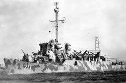
![]() USS Pavlic - APD-70
USS Pavlic - APD-70